
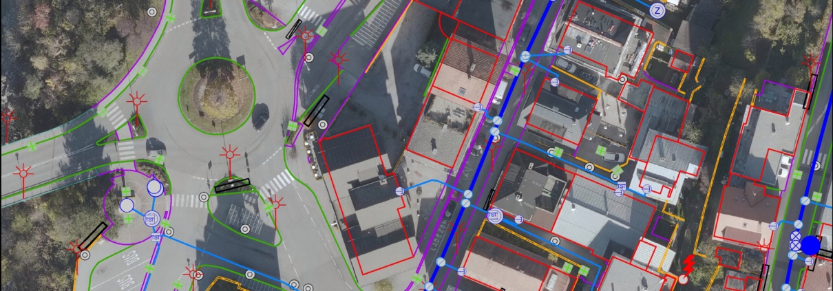
The municipalities and line operators have built or modernized extensive infrastructure systems (sewer, water, electricity, public lighting, fiber optic cables/optic fibers, ...) over the past decades.
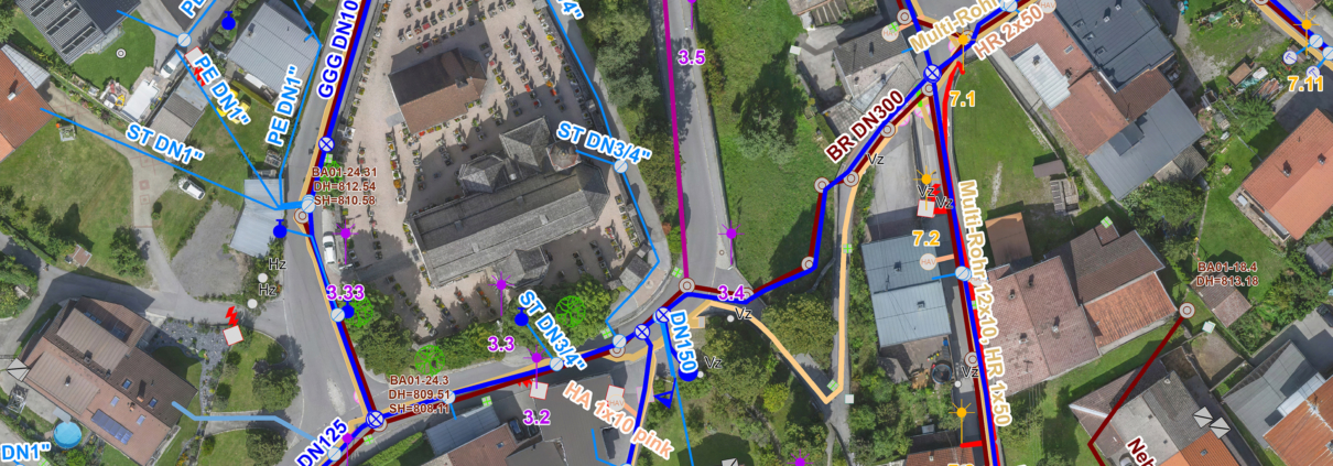
In order to document the information of these pipeline systems and to secure it for the future, the introduction of a digital pipeline information system, LIS for short, is necessary. This system not only visualizes and stores the geographical location of pipelines and infrastructure objects, but also the associated information, such as the material and dimensions of a pipeline or the illuminant of a street lamp.
For more than 50 years we have been surveying infrastructure, supply and disposal lines on behalf of municipalities, wastewater associations, water cooperatives and energy supply companies.
Where previously hand sketches were made with pencil and paper, all information is now quickly available at the click of a mouse!
We offer total solutions for the creation of a pipeline information system and supplementary as-built surveying:
- Individual advice on the scope of an LIS and the funding options available
- Funding processing or cooperation with the community water planners
- Creation of high-resolution orthophotos
- Photogrammetric evaluation and terrestrial supplementary surveying
- Field work with recording of the pipeline and objects as well as location of various pipelines and leak detection
- GIS data creation, data management and continuation
For more info read our Brochures or contact us.
Your contact persons:

Mario Stigger
+43 50 6930-131

Rainer Krammer, Dipl.-Ing.
+43 50 6930-344